Tag: maps
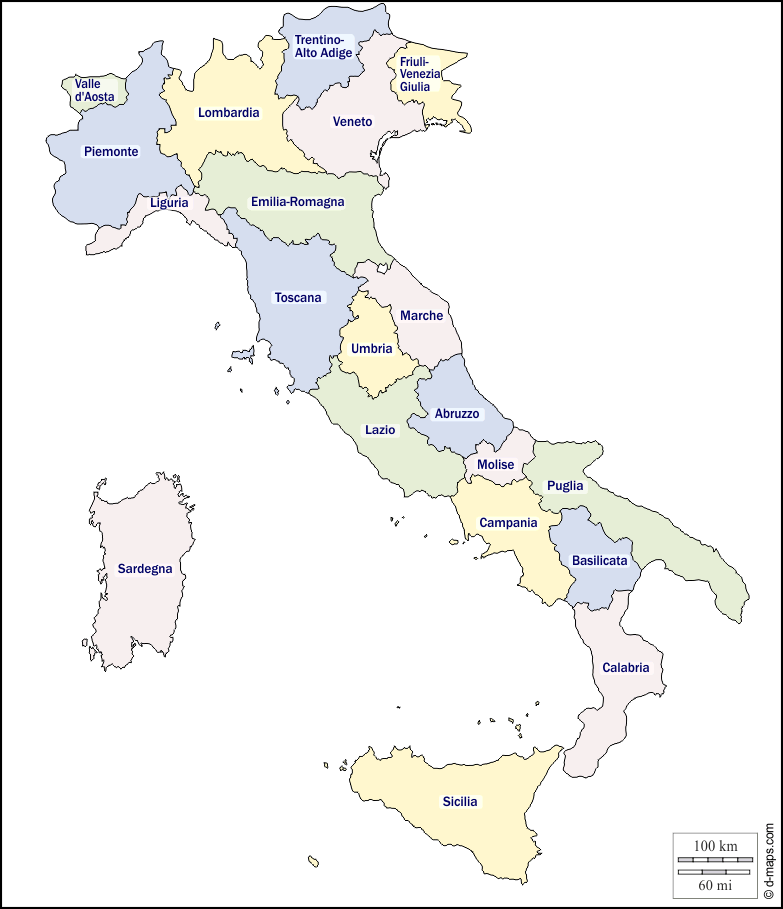
The 20 Regions of Italy
Italy is made up of 20 regions, each with its own history, flavors, customs, and local dialects. Some regions, like Tuscany and Sicily, are well-known as travel destinations, while others like Lazio, Lombardy, and Piemonte, are overshadowed by their capitals Rome, Milan, and Turin. It’s worthwhile to educate yourself about the regions of Italy before

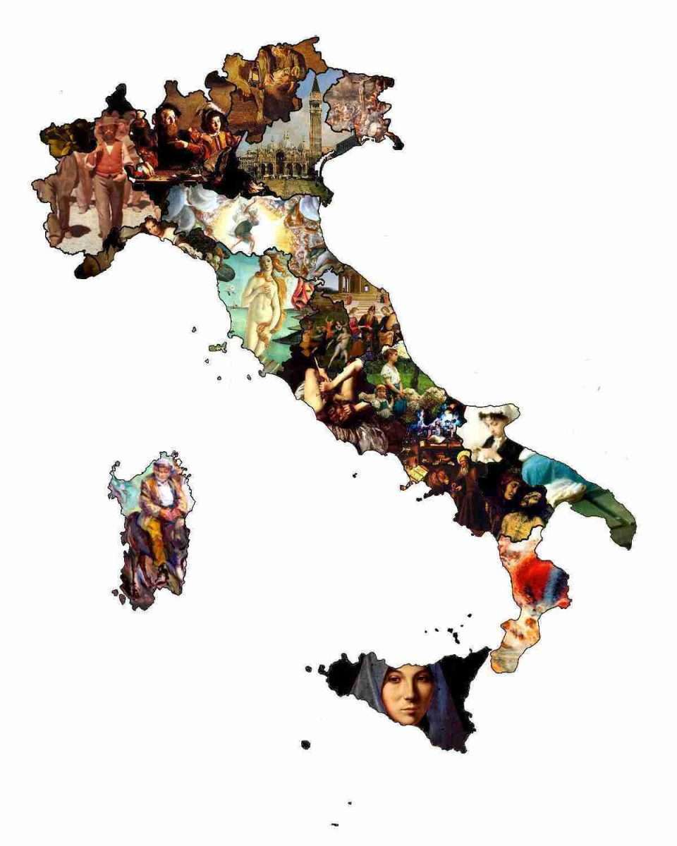
An Italian Artist for Every Italian Region [Map]
This Italian map is fun but certainly controversial. It is a map of each region in Italy represented by a painting or fresco by an artist of that region. Here’s the full map (click to zoom in). A list of the artworks and their creators follow. Alphabetical List of Italian Regions with Their Representative Artworks

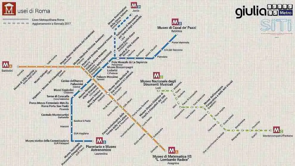
Rome’s Museums On A Metro Map
Rome is often called an outdoor museum. But the capital also has dozens of museums to explore, not only in the Centro Storico but beyond the walls. Helping us locate all of these museums and galleries is a new map showing Rome’s museums as they relate to metro stops.

The 7 Hills of Rome: What Are They and What Can You See?
Rome is a city of many hills. But the seven hills of Rome are the original hills on which the ancient city was founded.